

The interest of the last few years in the definition of a geological-environmental knowledge framework of the Tuscan territory has resulted in a series of activities for the collection, computerisation and adaptation of geological and geotechnical data, dispersed in different paper and digital archives of public bodies, with the aim of creating a homogeneous digital synthesis archive. This archive, named Banca Dati Indagini Geotematiche (BDIG) (Geotechnical Investigation Database), has been realised within the framework of the research activities of the Scientific Collaboration Agreements between the Consortium “Laboratorio di Monitoraggio e Modellistica ambientale per lo sviluppo sostenibile – LaMMa” (Laboratory of Environmental Monitoring and Modelling for Sustainable Development – LaMMa) and the GeoTechnology Centre (CGT) of the University of Siena in the period 2008-2011.
The acquisition of geo-thematic data in the BDIG was articulated in two main phases
– Collection and implementation of the Municipal Structural Plans, in order to provide a cognitive framework, on a municipal scale, of the geotechnical and hydrogeological knowledge of the regional territory;
– completion and updating of geological and technical knowledge derived from archives of regional interest. In the first phase, the typical source of geotechnical data was the municipal Structural Plan, as the basic urban planning instrument for the coordination of territorial planning. The Structural Plan, being accompanied by geological, geotechnical and hydrogeological documentation, resulting from activities of homogenisation and synthesis of the available data, according to the regulations in force on territorial planning and defence of environmental resources, represents a coherent and complete cognitive tool to be valorised with digital diffusion and publication.
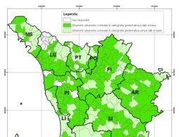
In the second phase of the updating and valorisation of the Region of Tuscany’s geo-thematic data heritage, geo-thematic data were acquired from national and regional archives, such as the Regional Programme for the Evaluation of Local Effects in Urban Centres, Strategic and Relevant Buildings (VEL Programme), the Oil Exploration Data Visibility Project in Italy (ViDEPI Project), the Geothermal Wells and Springs Data Bank (BDPGS) and the Geological Mineral Database (DBGM). These archives acquired in the BDIG arise from the need to define and make usable a set of territorial and environmental data in order to support spatial planning for the management of natural resources (DBGM, BDPGS and ViDEPI Project) and seismic risk mitigation (VEL Programme). In the BDIG there are 40205 geotechnical investigations, whose location is reported according to a punctual or linear geometry depending on the type (e.g. geognostic survey, seismic profile, etc.). It should be noted that the geotechnical parameters and stratigraphies referred to the investigations can be consulted in digital attachments related to the geometric elements that represent their location. In addition, the BDIG makes it possible to display 8558 digital attachments, which show, for example, the geological-technical report of the municipal territory accompanied by the relative thematic cartography (geology, hydrogeology, lithotechnics, etc.).