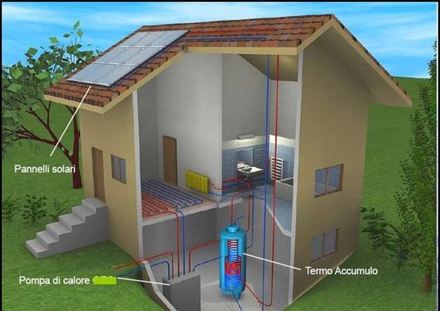
The project ‘Management of the very low enthalpy thermal resource’, started in 2008 and ended in 2010, consists in taking and returning inexhaustible thermal energy from the ground, which is transformed into high-efficiency thermal energy by means of heat pumps to heat or air-condition rooms, guaranteeing energy savings compared to traditional forms of energy.
Despite the fact that Italy has particularly favourable conditions for the development of these plants, few regions have yet developed guidelines, operating procedures and efficient control systems for the exploitation of geothermal resources for heating and cooling private environments.
With reference to the positive environmental and economic effects of using these systems, the project initially carried out research to define the most advanced knowledge on the national and international legislative and authorisation panorama.
In parallel with this study, the project included the definition of the different types of systems, with particular attention to the technical and engineering aspects. The completion of knowledge on the subject in question is developed through the analysis of the most efficient technical standards at European level (Germany, Switzerland and France), evaluating their applicability to the Tuscan geological and climatic context.
The project proposed to define a criterion for determining the potential in terms of thermal yield, starting from the stratigraphic and hydrogeological data available. The main objective of the project was the acquisition of information on the plants already installed on the regional territory and the design and creation of a database containing all the information “Banca Dati delle Sonde Geotermiche -BDSG”.
Within the project, an innovative and unique Web Gis service at national level was created.
Through this tool it is possible to:
-relate the location with respect to the information of physical and morphological characteristics;
-compare the position of the installed systems and geological information at different scales;
-view the technical data and information contained in the technical and geological reports.


